倫納德頓
倫納德頓(英語:)是美國馬里蘭州聖瑪麗斯縣的縣治。[4]根據2010年人口普查,本城共有人口2,930人。[5]
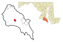
| 倫納德頓 Leonardtown, Maryland | |
|---|---|
| 鎮 | |
 | |
| 坐标:38°17′43″N 76°38′17″W | |
| 國家 | 美國 |
| 州 | 馬里蘭州 |
| 縣 | 聖瑪麗斯縣 |
| 成立 | 1660年(當時名為西摩鎮) |
| 註冊成立 | 1858年 |
| 語源 | 本篤倫納德·卡爾弗 |
| 政府 | |
| • 类型 | 註冊成立城鎮 |
| 面积[1] | |
| • 总计 | 3.25 平方英里(8.42 平方公里) |
| • 陸地 | 3.18 平方英里(8.24 平方公里) |
| • 水域 | 0.07 平方英里(0.18 平方公里) |
| 海拔 | 85 英尺(26 公尺) |
| 人口(2010年)[2] | |
| • 總計 | 2,930人 |
| • 估计(2012[3]) | 3,179 |
| • 密度 | 921.4人/平方英里(355.8人/平方公里) |
| 时区 | 北美東部時區(UTC-5) |
| • 夏时制 | 北美東部時區(UTC-4) |
| ZIP代碼 | 20650 |
| 電話區號 | 301/240 |
| FIPS代碼 | 24-46475 |
| GNIS代碼 | 0594790 |
| 網站 | http://leonardtown.somd.com |
地理
倫納德頓的座標為38°17′43″N 76°38′17″W(38.295332, -76.637939)。[6]根據2000年人口普查,本城面積為3.25平方英里(8.42平方),其中3.18平方英里(8.24平方)為陸地,0.07平方英里(0.18平方)為水域。[1]
參考文獻
- . United States Census Bureau. [2013-01-25]. (原始内容存档于2011-02-20).
- . United States Census Bureau. [2013-01-25]. (原始内容存档于2012-02-17).
- . United States Census Bureau. [2013-06-26]. (原始内容存档于2013-06-17).
- . National Association of Counties. [2011-06-07].
- "2010 Census P.L. 94-171 Summary File Data" (页面存档备份,存于). United States Census Bureau.
- . United States Census Bureau. 2011-02-12 [2011-04-23].
外部連結
This article is issued from Wikipedia. The text is licensed under Creative Commons - Attribution - Sharealike. Additional terms may apply for the media files.