哥伦比亚河峡谷
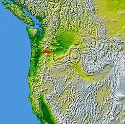
哥伦比亚河峡谷(英語:)是位于美国太平洋西北地区哥伦比亚河的一个峡谷。峡谷最深处达到4,000英尺(1,200),长度超过 80英里(130), 随着哥伦比亚河蜿蜒穿过喀斯喀特山脉,是其北岸华盛顿州和南岸俄勒冈州的自然边界。哥伦比亚河峡谷的起始点为Deschutes河与哥伦比亚河交汇处,向西一直到达波特兰市区。哥伦比亚河峡谷是穿过喀斯喀特山脉、连接哥伦比亚高原()和太平洋的唯一水运通道。
| Columbia River Gorge | |
| Protected Area | |
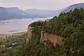
[[File: Columbia river gorge from crown point.jpg|256px|none|Looking east up the Columbia River Gorge from Crown Point. {{|}}]] Looking east up the Columbia River Gorge from Crown Point. | |
| 官方名称:Columbia River Gorge National Scenic Area | |
| 国家 | |
|---|---|
| 省/州/邦 | 俄勒冈州、华盛顿州 |
| 地区 | 太平洋西北地区 |
| 建立 | 1986 |
 | |
| 网站:http://www.fs.fed.us/r6/columbia/ | |
图集
 Crown Point in the Columbia River Gorge, looking upstream from Chanticleer Point.
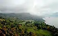 Columbia River Gorge, photographed from the southern edge of the Gifford Pinchot National Forest.
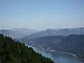 The view east towards The Dalles from Dog Mountain.
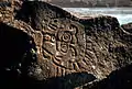 Native Indian petroglyphs in the Columbia River Gorge near The Dalles Dam.
 Kitesurfing on the Columbia River.
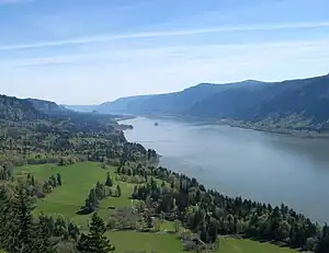 View of Columbia River Gorge from Cape Horn Trail, looking east toward Beacon Rock.
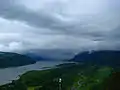 Columbia River Gorge, photographed from Crown point.
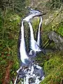 Triple Falls
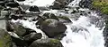 Oneonta Creek
参考文献
外部链接
- U.S. Forest Service(页面存档备份,存于) - Columbia River Gorge National Scenic Area
- Columbia River Gorge Commission(页面存档备份,存于)
- Columbia Gorge Magazine(页面存档备份,存于)
- Template:Oregon Encyclopedia
- Portland State University Columbia River Gorge National Scenic Area Collection -- contains research material used to write the book Planning a New West: The Columbia River Gorge National Scenic Area
Template:Columbia River Template:Ice Age Floods Template:Oregon
Template:Protected Areas of Oregon
This article is issued from Wikipedia. The text is licensed under Creative Commons - Attribution - Sharealike. Additional terms may apply for the media files.