怀特河 (密西西比河支流)
怀特河(英語:)是密西西比河的一条支流,流经美国的阿肯色州和密蘇里州,长约1162个公里。
| 怀特河 White River | |
| River | |
[[File: White River, Arkansas.jpg|300px|none|怀特河一景,拍摄于2008年 {{|}}]] 怀特河一景,拍摄于2008年 | |
| 国家 | |
|---|---|
| 省/州/邦 | |
| 支流 | |
| - 左侧支流 | James River、North Fork River、Black River |
| - 右侧支流 | Buffalo River、Little Red River、Bayou des Arc |
| 城市 | 紐波特、貝茨維爾、费耶特维尔 |
| 源头 | Boston Mountains |
| - 位置 | 阿肯色州麥迪遜縣欧扎克-圣弗朗西斯国家森林 |
| - 海拔 | 2,260 ft(689 m)[1] |
| 河口 | 密西西比河 |
| - 位置 | 阿肯色州迪沙县 |
| - 海拔 | 188 ft(57 m)[2] |
| 长度 | 722 mi(1,162 km) |
| 流域面积 | 27,765 mi²(71,911 km²)[3] |
| 流量 | Devalls Bluff |
| - 平均流量 | 26,180 ft³/s(741 m³/s)[4] |
| - 最大流量 | 154,000 ft³/s(4,361 m³/s) |
| - 最小流量 | 3,230 ft³/s(91 m³/s) |
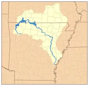 怀特河流域图
| |
参考文献
- Google Earth elevation for GNIS source coordinates.
- Google Earth elevation for GNIS mouth coordinates.
- Availability of the Draft Environmental Impact Statement for the White River Minimum Flow Reallocation Study, AR | Federal Register Environmental Documents | USEPA
- http://pubs.usgs.gov/wdr/2005/wdr-ar-05/WDR-AR-05-1.pdf USGS Water Data Reports for the United States, 2005.
This article is issued from Wikipedia. The text is licensed under Creative Commons - Attribution - Sharealike. Additional terms may apply for the media files.